
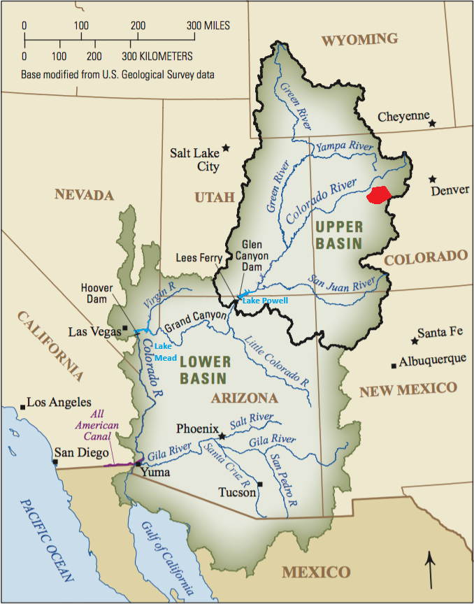
Colorado River Basin
Snowmass Water and Sanitation District is located in the the Roaring Fork Valley (region highlighted in red below), which comprises only .5% of the total land mass of the Colorado River Basin, but provides over 10% of the water volume entering the river system. The Colorado River provides water for 40 million people across 7 states, 30 tribal nations and 2 countries. Our local contribution to the river is critical.
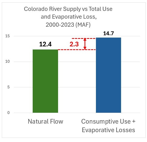
Water Supply vs Demand (Use + Evaporation)
Since 2000, natural flow in the basin (what nature has supplied) has been 10-20% less than consumptive use and evaporative loss. During this period, total basin depletions have exceeded natural supply by approximately 2 to 3 million acre-feet per year.
This structural imbalance has contributed to the significant decline in storage in Lake Mead and Lake Powell, the system’s two largest reservoirs.
For more detailed info about water accounting in the Colorado River Basin, click here.
Projected Flows in the Colorado River Basin
Current projections suggest that Colorado River flows could decline by roughly 30% over the next 30 years. This projected reduction builds on substantial decreases already observed over the past 25 years.
How we can help: conservation in Snowmass Village
What's Happening Downstream: Lake Powell Elevation
The current elevation of water in Lake Powell is preciptously close to the minimum elevation set by the Federal Bureau of Reclamation that includes a buffer for power generation and proper functioning of the dam. Current level as of early May, 2026 sits 1 foot above that minimum level.

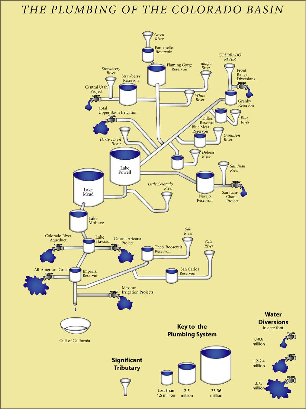
Inflows, Storage and Outflows from the Colorado River Basin
The River throughout history: "The River They Knew"
For two million years, humpback fish knew the River as a place to breathe, a place to eat, the route to spawning grounds. The River was their home. The Shoshone, Arapaho, Ute, Paiute, Hopi, Zuni and Navajo people knew the River when it was a wild torrent in the spring and a shallow, thread-like oasis in the summer. Adjacent meadows fed their horses and attracted game that fed the people. Fur trappers knew the River for the beaver, for a cool drink, for a quiet place to camp in the shade. Emigrants knew the River as the half-way point to Oregon and California, as a place to wash dingy clothes and as another obstacle to ford. John Wesley Powell knew the River as a force that can crush a boat and carve magnificent, colorful canyons. Pioneers knew the River as a source of irrigation water for their crops - if only they could divert the water. Real estate developers knew the River could make small desert communities blossom into beautiful cities. Miners knew the River could provide the water they needed to smelt copper, iron, silver and gold, to slurry coal and phosphate, to generate steam and electricity, to refine oil.
Source: Unknown